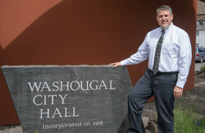
Paul Greenlee, a Washougal city council member, thinks Washougal is a gem. The town lies directly west of the Columbia River Gorge National Scenic area; salmon and steelhead swim in the Washougal River (a river that has no dams); and the eastern side of town borders the Steigerwald Lake National Wildlife Refuge.
So when it comes to planning the city’s growth over the next 20 years, Greenlee says, “A: take advantage of [the assets of the region], and B: don’t screw it up.”
The city of Washougal is currently undergoing an intensive land use study that will help define how the city will grow and develop in the coming decades. The study, expected to be adopted by the Washougal City Council this summer, will identify areas best suited for residential, commercial and industrial development, recommend new zoning and development codes, and determine which areas should be set aside for parks and open space, and which spaces should be more densely developed.
Mitch Kneipp, Washougal’s community development director, says it’s an exciting process.
“We’re getting the chance to re-envision and take advantage of what we have,” he says.
“In the past, we’ve got in trouble by doing these things piecemeal,” Greenlee adds. “We need to think about the city as a whole … and how these pieces fit together.”
Late last year, the city annexed 186 acres in the northwestern part of Washougal. The area was zoned as an “employment center” when Washougal’s urban growth boundary was adopted in 2007. This designation would have allowed for light commercial development in the area, including businesses like banks, small restaurants and professional services, but the zoning designation didn’t make a lot of sense to Greenlee and other city leaders; the annexed area is located on steep terrain and is a five-mile drive from Washougal’s downtown district.
“It doesn’t fit in,” Kneipp says, adding that the costs of development and adding utility services to support business development in that area of Washougal would be prohibitively expensive for the city.
In January, the city declared a six-month moratorium on new development in the annexed land and entered into a $225,000 professional services agreement with BergerABAM, a local consulting firm, to conduct the land use study of the annexed area and an additional 800 acres north of the Washougal and within its urban growth boundary.
The city council established a Technical Advisory Committee and a second committee devoted to downtown revitalization as part of the process, and both groups were made up of representatives from city council, business leaders and property owners. Greenlee and Kneipp served on both committees.
The study and the committees’ work, Kneipp says, has prompted stakeholders to think carefully about what they want the future of Washougal to be like.
“Do we really want employment lands up on the hill or [do we want to] make sure that we have employment lands in our city center? If [the later] is the case, what do we want up on the hill? What do we want it to look like?” Kneipp asks.
When the process started, the land available for residential and commercial development represented 200 percent of what Washougal predicts it will need for employment land and 107 percent for residential home development. Now, the city can accommodate 140 percent of residential growth and 140 percent of employment growth—an ambitious number, Greenlee says, that ensures Washougal’s economy can continue to grow and add jobs in the next 20 years.
The planning also ensures that Washougal will avoid developing areas that do not have infrastructure, such as sewer, utilities, and roads large enough to accommodate parking and traffic typical in a business district, in rural areas.
The recently annexed lands, according to draft plans, will now be zoned for low, transitional and medium-density residential development, with lot sizes for homes ranging between 8,000 and 15,000 square feet in size. Open space for parks and trails, which will connect to other natural spaces, will be preserved.
Density will be a prioritization for Washougal’s downtown core, according to Kneipp, who says there will be future policy discussions regarding “employment infill,” or how to add more jobs in the downtown area. It’s also possible that apartment buildings, townhomes and denser residential development will take place in the downtown core.
“That’s the density we want in our town center,” Kneipp says. “And there will be an alternative on the hillside, to have larger lots and more of a rural feel.”
Kneipp notes that the mixture of density and development in distinct parts of the city will cater to different types of people living in Washougal, ensuring that the city can attract new residents and grow.
“There will be people who want to live in downtown, with neighbors very close by,” he says. “Then there’s other folks who love to come and shop and visit, but go back out and be on their land.”
The new zoning and regulations will not be included in Washougal’s new Comprehensive Plan, which is currently in draft form and is expected to be approved next month. Kneipp regrets that the city did not start the planning discussions that are currently underway as early as 2013, which would have ensured the new planning framework would have been included in the city’s comprehensive plan.
Kneipp says it was impossible at that time to predict the annexations, which prompted the discussions. However, both Kneipp and Greenlee say Washougal’s comprehensive plan can easily be amended in the future.


